Geographical latency is communication delay caused by physical distance between clients, servers, or other communicating locations. It is a major component of network latency and often dominates application latency because signals cannot exceed the speed of light. Optimization therefore focuses on avoiding long round trips rather than making the distance itself faster. section 3.2.1
A production failure across the Atlantic
A real-time system appeared responsive when tested locally, but became too slow in production because it ran on the wrong side of the Atlantic. The deployment exposed the system to roughly 100 milliseconds of round-trip latency, demonstrating why production network measurements and latency baselines matter. section 3.2.1
Use geographical latency analysis to:
- Measure expected network latency between users and services before optimizing application-level code. section 3.2.1
- Place compute and data near users through multiple regions or metropolitan points of presence. section 3.1
- Partition geographically related data so proximity queries search smaller, nearby datasets. section 5.3.2
- Account for movement and boundary effects, which can require migrating records or searching multiple partitions. section 5.3.2
Figure 3.2 Geographic latency. The geographic distance between two nodes implies latency. For example, Hibernia Express advertises 60 ms round-trip between New York and London. Light travels the same distance in vacuum in 19 ms, so the minimum theoretical round-trip latency is 38 ms.
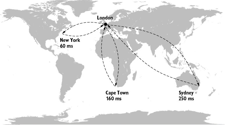
Compare advertised and theoretical round-trip latency between New York and London: 60 milliseconds advertised versus 38 milliseconds for light in vacuum. section 3.2.1