Spatial positioning represents information through where marks or elements appear in visual space. It is especially effective for geographic location and numerical values, such as latitude and longitude or x and y values in a scatter plot. section 2.1.3 section 2.3
London bike rentals
A set of maps places morning rentals above evening rentals and starting stations to the left of ending stations. The resulting four panels make changes in rental patterns visible: morning arrivals concentrate more in Central London, while evening trips show the reverse tendency. section 2.1.3
Position also works beyond maps and charts. On a page, placement and alignment guide importance, balance, and grouping. In a Western reading context, the top-left area commonly receives early attention, so titles and subtitles can occupy that location while less important material moves down or right. Alignment can create visual order: centered text balances a layout, while right-aligned axis labels form a clean unifying edge. section 5.4.3
Figure 2.5 Maps of London showing morning rentals in the first row and evening rentals in the second row. In the columns, we have the locations of the starting and ending rental stations on the left and right, respectively. Thus, the starting locations for morning rentals are in the upper left, the ending stations for the evening rentals are in the lower right. The other two permutations are at their respective locations in between. (Base map © Mapbox © OpenStreetMap. See https://www.mapbox.com/about/maps/ and https://www.openstreetmap.org/copyright.)
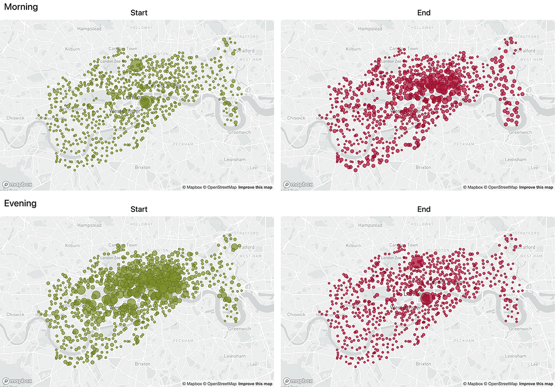
Compare four London rental maps arranged by time of day and trip direction. section 2.1.3
Figure 5.26 The position and alignment of text can be used to establish importance (header and subtitle position), as well as bring balance (centered text on the pair of bar graphs and the callout) and unification (the clean line of the right-justified axis labels on the right).
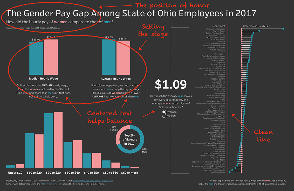
Inspect how text position and alignment establish importance, balance, and unification in a page layout. section 5.4.3
Use spatial positioning when you need to:
- Show geographic location or numerical relationships. section 2.1.3
- Separate categories through location or arrangement. section 2.1.3
- Guide attention, balance a page, or unify related labels. section 5.4.3