A 3D point cloud is a collection of points in three-dimensional space. Each point stores coordinates and may carry attributes such as color, timestamp, or intensity. Point clouds preserve spatial measurements of real environments and can capture complex geometry or track physical changes over time. section 2.4.2 section 2.7
LiDAR produces point clouds by emitting laser pulses, measuring their return times, and calculating 3D coordinates. A cloud may contain millions to billions of points. Accuracy depends on the hardware: consumer smartphone sensors can provide centimeter-level accuracy, while survey-grade terrestrial scanners can reach millimeter-level precision. section 7.4.5
Figure 2.12 A point-cloud visualization of the center of Amsterdam. Source: http://ahn2.pointclouds.nl/. Licensed under CC0 1.0 Universal (Public Domain).
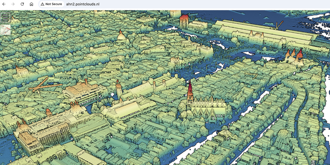
This visualization shows a point cloud representing the center of Amsterdam. section 2.4.2
Choose a representation for the decision it must support:
- Use LiDAR point clouds for precise as-built documentation, structural inspection, or measurements of physical geometry. Capture equipment can be expensive, and working with the data requires higher-performance hardware. section 7.6
- Use mesh-based models when rendering performance and interactive visualization matter more; use building information models when component semantics and operational metadata are central. section 2.4.2 section 7.6
- Use photogrammetry when photorealistic textures are important, while allowing for intensive processing and lower geometric precision than LiDAR. section 7.6
Measuring a sand pile
An iPad Pro LiDAR sensor and the 3D Scanner app can capture a model of a sand pile for volume measurement. One such model yielded an estimated volume of approximately 1.6 cubic meters. The same principle applies to ore stockpile measurements, but sensor limitations should guide expectations for accuracy. section 7.4.5